
Shelton 🇺🇸
-
Nautical Twilight begins:04:39 amSunrise:05:46 am
-
Sunset:07:52 pmNautical Twilight ends:09:00 pm
-
Moonrise:03:30 am
-
Moonset:02:38 pm
-
Moon over:09:04 am
-
Moon under:09:17 pm
-
Visibility:26%
-
 Waning Crescent
-
Distance to earth:363,640 kmProximity:98.7 %
Moon Phases for Shelton
-
good Day
-
minor Time:02:30 am - 04:30 am
-
major Time:08:04 am - 10:04 am
-
minor Time:01:38 pm - 03:38 pm
-
major Time:08:17 pm - 10:17 pm
Tide Clock
Tide Graph
Times
| Tide | Time | Height |
|---|---|---|
| low | 02:41 am | 0.69 ft |
| high | 08:18 am | 7.09 ft |
| low | 03:12 pm | 0.23 ft |
| high | 08:52 pm | 7.32 ft |
| Date | Major Bite Times | Minor Bite Times | Sun | Moon | Moonphase | Tide Times |
|---|---|---|---|---|---|---|
|
Fri, 03 May
|
08:04 am -
10:04 am
08:17 pm -
10:17 pm
|
02:30 am -
04:30 am
01:38 pm -
03:38 pm
|
R: 05:46 am S: 07:52 pm |
R: 03:30 am S: 02:38 pm |
Waning Crescent |
low: 02:41 am
, 0.69 ft
high: 08:18 am
, 7.09 ft
, Coeff: 113
low: 03:12 pm
, 0.23 ft
high: 08:52 pm
, 7.32 ft
, Coeff: 119
|
|
Sat, 04 May
|
08:54 am -
10:54 am
09:06 pm -
11:06 pm
|
02:55 am -
04:55 am
02:54 pm -
04:54 pm
|
R: 05:45 am S: 07:53 pm |
R: 03:55 am S: 03:54 pm |
Waning Crescent |
low: 03:44 am
, 0.23 ft
high: 09:20 am
, 7.22 ft
, Coeff: 116
low: 04:06 pm
, 0.03 ft
high: 09:47 pm
, 7.84 ft
, Coeff: 133
|
|
Sun, 05 May
|
09:44 am -
11:44 am
09:56 pm -
11:56 pm
|
03:18 am -
05:18 am
04:11 pm -
06:11 pm
|
R: 05:44 am S: 07:54 pm |
R: 04:18 am S: 05:11 pm |
Waning Crescent |
low: 04:43 am
, -0.23 ft
high: 10:17 am
, 7.38 ft
, Coeff: 121
low: 04:58 pm
, -0.16 ft
high: 10:39 pm
, 8.27 ft
, Coeff: 145
|
|
Mon, 06 May
|
10:35 am -
12:35 pm
10:49 pm -
12:49 am
|
03:42 am -
05:42 am
05:28 pm -
07:28 pm
|
R: 05:42 am S: 07:55 pm |
R: 04:42 am S: 06:28 pm |
New Moon |
low: 05:38 am
, -0.62 ft
high: 11:11 am
, 7.48 ft
, Coeff: 124
low: 05:48 pm
, -0.26 ft
high: 11:28 pm
, 8.56 ft
, Coeff: 153
|
|
Tue, 07 May
|
11:28 am -
01:28 pm
11:12 pm -
01:12 am
|
04:09 am -
06:09 am
06:48 pm -
08:48 pm
|
R: 05:41 am S: 07:57 pm |
R: 05:09 am S: 07:48 pm |
New Moon |
low: 06:29 am
, -0.85 ft
high: 12:02 pm
, 7.51 ft
, Coeff: 124
low: 06:37 pm
, -0.26 ft
|
|
Wed, 08 May
|
12:05 am -
02:05 am
12:24 pm -
02:24 pm
|
04:41 am -
06:41 am
08:07 pm -
10:07 pm
|
R: 05:40 am S: 07:58 pm |
R: 05:41 am S: 09:07 pm |
New Moon |
high: 12:17 am
, 8.69 ft
, Coeff: 157
low: 07:20 am
, -0.92 ft
high: 12:52 pm
, 7.48 ft
, Coeff: 124
low: 07:25 pm
, -0.13 ft
|
|
Thu, 09 May
|
12:56 am -
02:56 am
01:20 pm -
03:20 pm
|
05:19 am -
07:19 am
09:21 pm -
11:21 pm
|
R: 05:39 am S: 07:59 pm |
R: 06:19 am S: 10:21 pm |
New Moon |
high: 01:05 am
, 8.6 ft
, Coeff: 154
low: 08:08 am
, -0.79 ft
high: 01:42 pm
, 7.35 ft
, Coeff: 120
low: 08:13 pm
, 0.1 ft
|


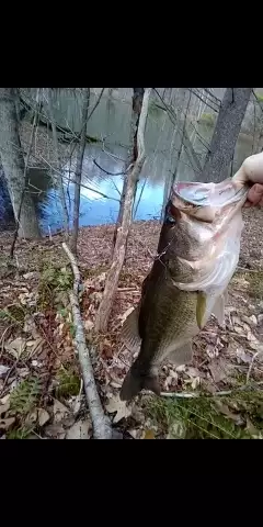
uploaded by: John Needham

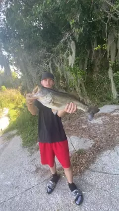
uploaded by: Lee Smith 1

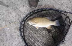
uploaded by: D2Turnt

uploaded by: PT Edward fisher

uploaded by: Charlie Pifer

uploaded by: Charlie Pifer

uploaded by: Charlie Pifer

uploaded by: Charlie Pifer

uploaded by: bariu

uploaded by: bariu
Shehlton,Shelton,seltana,xie er dun,Шелтон,Шэлтон,शेल्टन,谢尔顿
Best Fishing Spots in the greater Shelton area
Wharf's or Jetties are good places to wet a line and meet other fishermen. They often produce a fresh feed of fish and are also great to catch bait fish. As they are often well lit, they also provide a good opportunity for night fishing. There are 3 wharf(s) in this area.
Sow and Pigs Jetty - 2km , Burns Point Jetty - 12km , Long Jetty - 12km
Beaches and Bays are ideal places for land-based fishing. If the beach is shallow and the water is clear then twilight times are usually the best times, especially when they coincide with a major or minor fishing time. Often the points on either side of a beach are the best spots. Or if the beach is large then look for irregularities in the breaking waves, indicating sandbanks and holes. We found 2 beaches and bays in this area.
Fort Trumbull Beach - 12km , Gulf Beach - 12km
We found a total of 100 potential fishing spots nearby Shelton. Below you can find them organized on a map. Points, Headlands, Reefs, Islands, Channels, etc can all be productive fishing spots. As these are user submitted spots, there might be some errors in the exact location. You also need to cross check local fishing regulations. Some of the spots might be in or around marine reserves or other locations that cannot be fished. If you click on a location marker it will bring up some details and a quick link to google search, satellite maps and fishing times. Tip: Click/Tap on a new area to load more fishing spots.
Hawkins Point - 0km , O' Sullivan Island - 1km , Lake Housatonic Dam - 1km , Hog Island - 1km , Shelton Reservoir Number 3 Dam - 2km , Chordas Pond - 2km , Picketts Pond Dam - 2km , Lower Ansonia Reservoir Dam - 2km , Sow and Pigs Jetty - 2km , Lake Housatonic Dike - 2km , Upper Ansonia Reservoir Dam - 2km , Tri-Lake - 3km , Pink House Cove - 3km , Twomile Island - 3km , Quillinan Reservoir Dam - 4km , Parkers Pond - 4km , Wooster Island - 4km , Anaconda American Brass Company Dam - 4km , Fountain Lake Dam - 4km , Wepawaug Reservoir Dam - 5km , Colony Pond - 5km , Baird Millpond - 5km , Means Brook Reservoir Dam - 5km , Cranberry Pond - 6km , Lake Wepawaug - 6km , Pin Oak Pond - 6km , Middle Reservoir Dam - 6km , Spring Lake - 6km , Kinneytown Dam - 6km , Shelton Reservoir Number 2 Dam - 7km , Clarktown Pond - 7km , Peat Swamp Reservoir Dam - 7km , Great Hill Reservoir Dam - 7km , Trap Falls Reservoir Dam - 8km , Beaver Dam Lake - 8km , Cooks Pond - 9km , Rimmon Dam - 9km , Hoadley Pond Dam - 9km , Wire Company Dam Number 2 - 9km , Bantam Pond Dam - 9km , Kerite Dam - 9km , Fowler Island - 9km , Beaver Dam Lake Dam - 9km , Bishops Pond - 9km , Maltby Lakes West Dam - 9km , Broad Street Bridge - 9km , Bladens River Dam - 9km , Stevenson Dam - 10km , Rose Mill Pond - 10km , Clark Pond - 10km , Pinewood Lake Dam - 10km , Pinewood Lake - 10km , Indian Lake - 10km , Indian Lake Dam - 10km , Pecks Mill Pond - 10km , Frog Pond - 10km , Konolds Pond - 10km , Maltby Lake - 10km , Maltby Lakes North Dam - 10km , Lily Pond - 10km , Maltby Lake Dam Number 1 - 10km , Upper Lagoon - 11km , Quirks Pond - 11km , Popes Island - 11km , Lake Wintergreen - 11km , Thomson Bridge - 11km , Horseshoe Lagoon - 11km , Swan Lake Dam - 11km , Indian Neck - 11km , Smith Pond - 11km , Kaatz Pond - 11km , Kaatz Pond Dam - 11km , Memorial Bridge - 11km , Lake Wintergreen Dam - 11km , Center Pond - 11km , Long Island - 11km , Lower Lagoon - 11km , Carting Island - 12km , Prudden Point - 12km , Pine Bridge - 12km , Peacock Island - 12km , Nichols Pond - 12km , Baldwin Point - 12km , Motil Pond - 12km , Beaver Brook Dam - 12km , Walker Pond - 12km , Milford Harbor - 12km , Upper Lake Phipps Dam Number 2 - 12km , Upper Lake Phipps Dam Number 1 - 12km , Burns Point - 12km , Glen Lake Dam - 12km , Carrington Pond - 12km , Carrington Pond Dam - 12km , Burns Point Jetty - 12km , Lake Chamberlain Dam - 12km , Fort Trumbull Beach - 12km , Gulf Pond - 12km , Gulf Bridge - 12km , Gulf Beach - 12km , Long Jetty - 12km
Comments